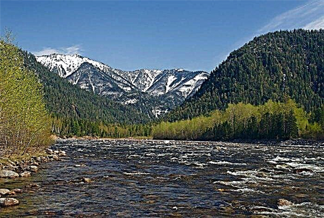
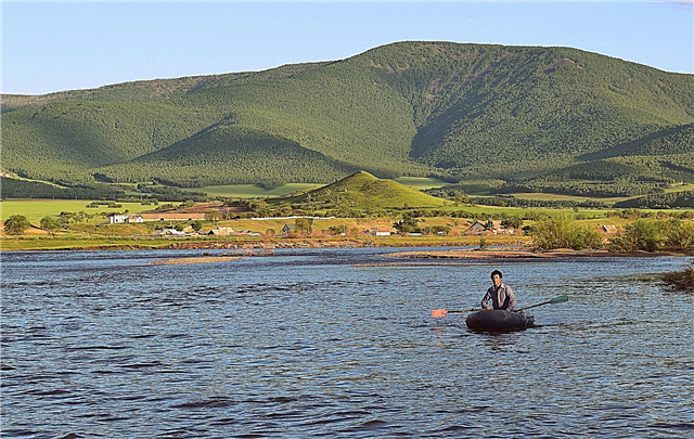
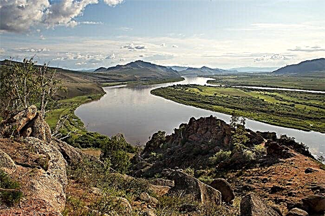
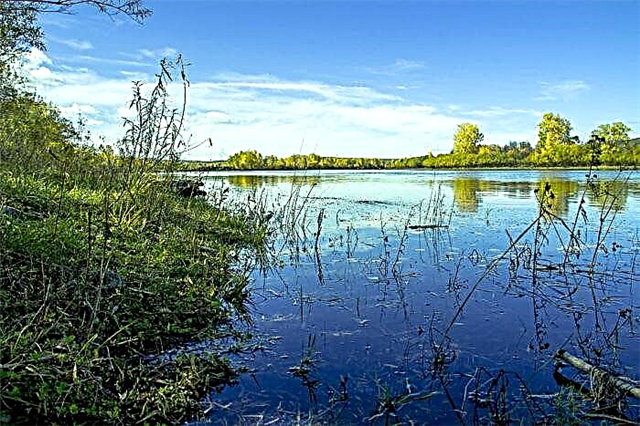
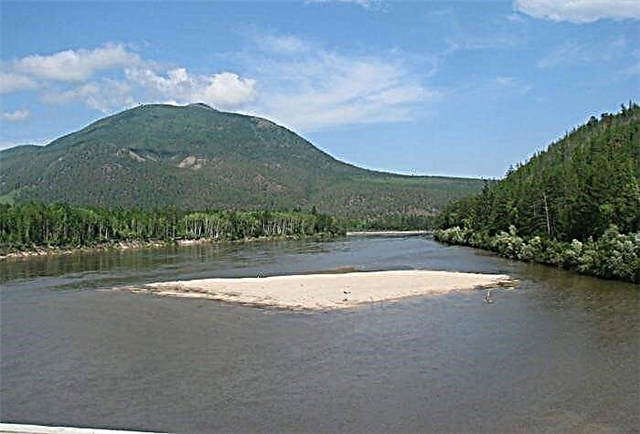
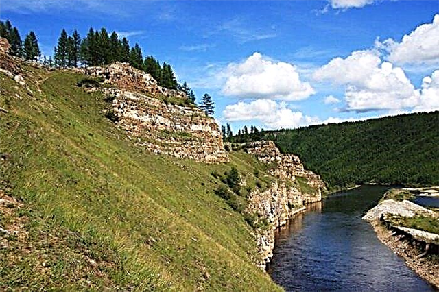
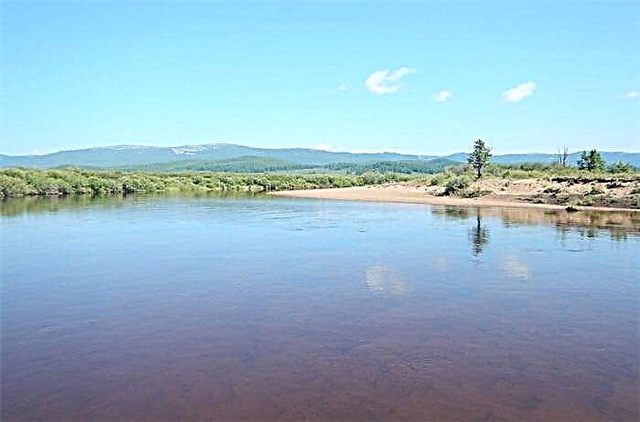
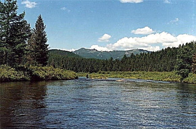
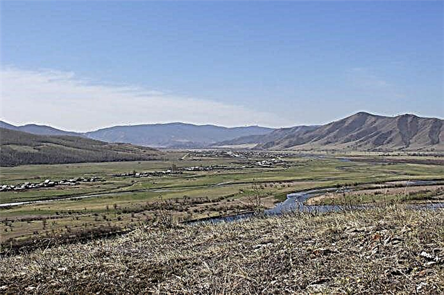
More than 30 thousand rivers, the total length of which is just over 150,000 km, are the real wealth of the republic. They are evenly distributed throughout the region. There are 25 large rivers, while most of the rivers are classified as small and medium. The rivers of Buryatia are included in the drainage basins of the Lena and Yenisei rivers, as well as Lake Baikal. The largest rivers of the republic that flow into Baikal are the Upper Angara, Barguzin, Selenga. In the north of the republic, the largest river is Vitim.
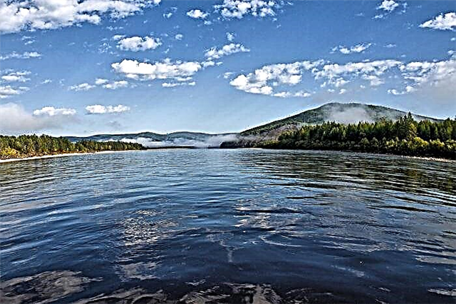
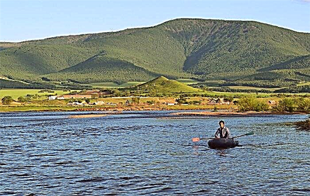
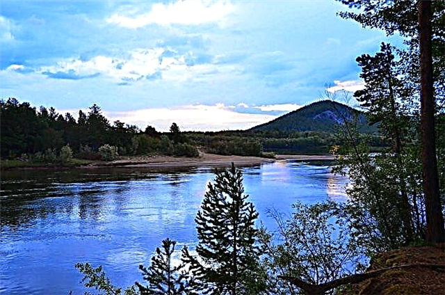
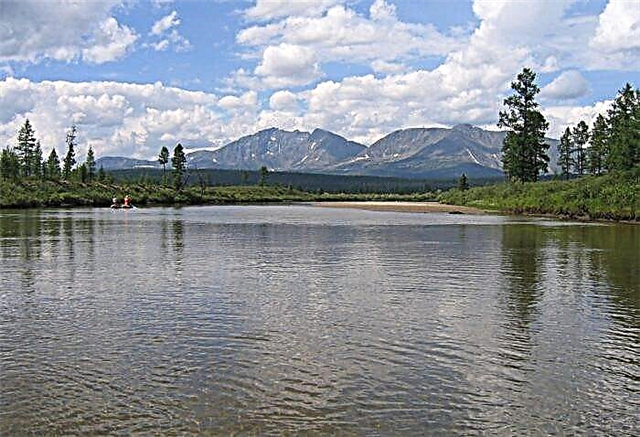
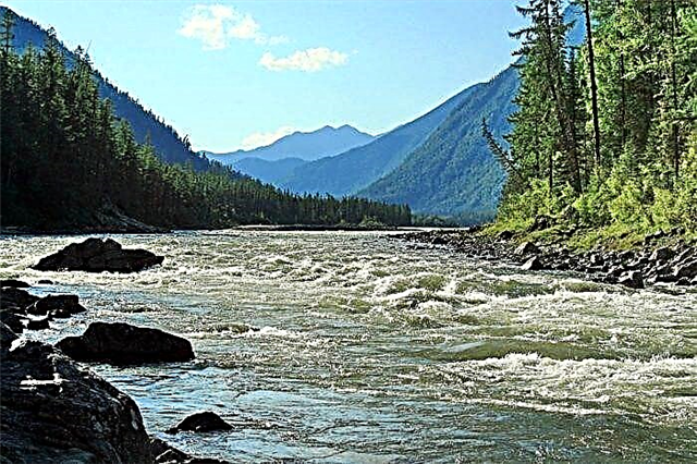
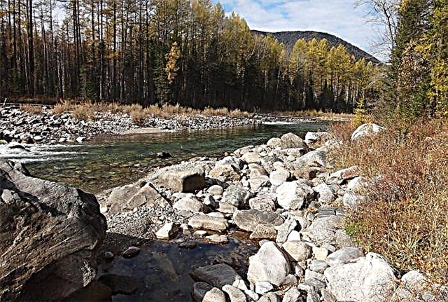
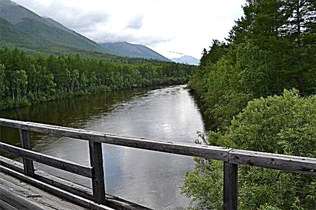
Rivers concentrated in the region of mountain ranges are of particular interest for rafting enthusiasts. Some of the water routes are suitable only for professional athletes due to the high category of difficulty of passage. Rest by the water is also interesting - the taiga nature on the river banks, clean air and deserted places far from civilization are especially appreciated by tourists.
The longest rivers in Buryatia
List of the largest rivers flowing through the region.
Vitim
Gold, mica and jade are mined in the river basin. Several rafting routes have been laid along the river. Particularly interesting is the route of the III category of difficulty with the rapids Delyun-Oronsky and Paramsky. The nature of the river is also difficult - calm stretches give way to rapids, shoals coexist with deep places. In addition to Buryatia, Vitim flows in the Trans-Baikal Territory, Yakutia and the Irkutsk Region.
The total length of the river is 1837 km.
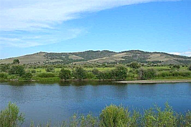
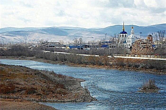
Selenga
The largest tributary of Lake Baikal, when it flows into the lake, forms a vast delta. Swimming places are located near the city of Ulan-Ude. Rafting on the Selenga is of the 1st category of difficulty. Interesting sights are located on the banks of the river - Obmannaya Mountain, Anglichanka Rock, Old Town tract. There are numerous archaeological sites from the Bronze and Stone Ages. It flows through Buryatia and Mongolia.
The length of the river is 1,024 km, in Buryatia - 409 km.
Khilok
Tributary of the Selenga River. Almost 2000 lakes have been formed in the river basin. The banks of the river are gentle, the bottom is sandy and pebble. Previously, the river was used for timber rafting, now it is navigable in the lower reaches. The inhabitants of the Khilok River are perch, pike, grayling, and chebak. Residents of villages on the banks of the river talk about good catches. There are many places to rest with tents on the banks. It flows through Buryatia and the Trans-Baikal Territory.
The length of the river is 840 km, in Buryatia - 170 km.
Chikoy
The taiga river has incredible beauty. The untouched nature of the river does not leave tourists indifferent. Rafting on Chikoy by boat is especially popular. The river is navigable 150 km from the mouth. However, there are no regular flights on this section of the river. The waters of the Chikoy River are used for irrigation of agricultural lands. It flows through Buryatia and the Trans-Baikal Territory, as well as through Mongolia.
The length of the river is 769 km, in Buryatia - 250 km.
Tsipa
The first 200 km from the source of the Tsipa has a calm current. Further, the river bed passes between the mountain ranges, becomes winding, and the current is impetuous. When rafting, this is one of the most difficult sections - more than 100 rapids, with a cliff height of up to 5 meters. On the sandy banks of the river there are many places for camping and camping with tents. The ichthyofauna of the river is made up of grayling, whitefish, taimen, pike, and perch.
The length of the river is 692 km.
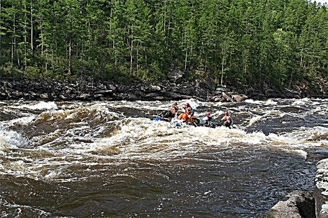
Oka (tributary of the Angara)
Rafting on the Oka River is incredibly popular among tourists from all over Russia. Several rapids are of IV category of difficulty. For the most part, they are located in the Sayan ridges. The best time for boat trips on the river is from June to September. The middle course of the river passes through a partly wetland covered with mixed forest. The Oka flows through the Irkutsk region and Buryatia.
The total length of the river is 630 km.
Jida
The upper course of the river passes through mountain-taiga narrow gorges. Below the river valley becomes wider, the current is calm and slow. These spots are well suited for beginner kayak riders. The river is used for rafting and boating. At mining sites, river waters are heavily polluted. Nevertheless, different types of fish live in the river - grayling, taimen, catfish, pike, lenok.
The length of the river is 567 km.
Chuya (tributary of the Lena)
The banks of the river are sparsely populated; it flows through marshy terrain. The largest tributary is the Malaya Chuya River. Chuya is characterized by rifts, shoals, channels and islands. The banks of the river are very beautiful, rich in vegetation. In the rock formations there are grottoes where you can swim in kayaks. Among fish, taimen, dace, grayling, whitefish are widespread. Chuya carries its waters through Buryatia and Irkutsk region.
The total length of the river is 512 km.
Irkut
Angara tributary. The river is floatable, water tourism is developed on it. Rafting sections are divided into sections of different categories of difficulty. Part of the river passes through the territory of the Tunkinsky National Park. The ecosystem of the mountain ranges of the river valley is under special protection of the state. The inhabitants of the Irkut River are grayling, catfish, burbot, bream, perch, and soroga. It flows not only in Buryatia, but also in the Irkutsk region.
The total length of the river is 488 km.
Barguzin
It flows through the Barguzin depression and the territory of the Dzherginsky national reserve. It flows into Lake Baikal. The protected areas attract many tourists. In the upper reaches, the river valley is a taiga, slightly marshy area. The current is calm here, difficult rapids of the III-IV categories of difficulty begin at the Ankokon breakthrough. There are several healing mineral springs near the river.
The length of the river is 480 km.
Uda
Most of the settlements on the banks of the river are concentrated in the Udi Valley. The middle course of the river flows through the protected areas of the Angirsky, Khudaksky and Mokheisky reserves. The river takes its source in the coniferous forests of the Vitim plateau. In late summer, during rain floods, the river overflows, causing flooding. It is a tributary of the Selenga; the city of Ulan-Ude is located on both banks of the river at the mouth.
The length of the river is 467 km.
Upper Angara
The source of the river is located among the mountain ranges, therefore, in the upper reaches, its course is rapid and rapids. However, most of the Upper Angara flows through a swampy plain. The inhabitants of the river are grayling, pike, ide, taimen. Baikal omul enters the river for spawning. There are several mineral water springs in the river basin with medicinal properties.
The length of the river is 438 km.
Muya
The river takes its source in a mountain lake between the Severo-Muisky and Muyakansky ridges. It is the upper section of the river that is most interesting for tourists - in a narrow picturesque valley, the current has a varied character - from rapid to calm. Downstream, the river passes through a wooded area - larch and cedar species grow here. The lower reaches of the river are rich in fish - whitefish, tugun, taimen, grayling.
The length of the river is 365 km.
Tea
The banks of the river are covered with forests, mostly deciduous with an admixture of spruce and cedar. The source is located in the mountains. The area around the river valley is marshy and sparsely populated. However, Chaya is suitable for rafting on small boats, as there are small rapids in its course. There is fish in Tea, but fishing on it is possible only on vouchers with observance of the norms. It flows through Buryatia and the Irkutsk region.
The total length of the river is 353 km.
Tsipikan
Two sources of the river are located on the Ikat ridge. The river valley is slightly boggy, the banks are mostly covered with forest and rare bushes. The average width of the river is from 58 to 77 meters, the depth is 1.5-2 meters. Tsipikan flows into freshwater Lake Bount, located in the west of the Bount Basin. Gold is mined in the Tsipikan River basin. The main tributaries are the Gorbylok and Taloy rivers.
The length of the river is 329 km.
Kitoy
The river is notorious for water rafting enthusiasts. An experienced sports tourism specialist died on one of its difficult rapids in 2003.On the banks of the river there are many natural attractions - unusual rocks and caves. In the Kitoy valley, hunting is developed, including for fur-bearing animals. Berries and mushrooms grow in large quantities. It flows in Buryatia and the Irkutsk region.
The total length of the river is 316 km.
Temnik
The river, which originates in the mountain ranges, flows through the Tamchinskaya plain and the Gusinoozerskaya depression. Part of the river passes near the natural biosphere Baikal reserve. Temnik is popular with water tourists; rafting on it has IV category of difficulty. A section of the river near the village of Taezhny is considered a safe site. The main inhabitants of the river are lenok, taimen, grayling.
The length of the river is 314 km.
Big White
It is formed by the confluence of the Sagan-Bilchir and Burun-Sagan-Bilchir rivers. The river bed runs through mountainous terrain, among small settlements. The banks of the river look picturesque, the steep cliffs going into the water are especially beautiful. There are waterfalls and rapids in the upper reaches of the river. Downstream the river becomes more calm. Jade and graphite are mined in the river basin. It flows through Buryatia and the Irkutsk region.
The total length of the river is 280 km.
Turk
The river originates in the mountains at an altitude of 1430 meters. It flows along the mountainous terrain along its entire length and flows into Lake Baikal. The name of the river from Evenk translates as "omul". It is in this river that the famous Baikal fish comes to spawn. A sanatorium is located near the rural settlement of Turkinskoye. The resort is interesting for its mineral springs, pristine natural views and a beach with reddish sand.
The length of the river is 272 km.
Khudan
Other names of the river are also known - Kodun, Kudun. Khudan is a tributary of the Uda. The source of the river is located between the low mountain ranges of Tsagan-Khurtei and Khurtey, near Mount Khudan, 1554 meters high. The spring flood of the river is small, but Khudan often floods heavily during rains and downpours. The ice cover on the river lasts from November to May. There are several small settlements in the Khudan valley.
The length of the river is 252 km.
Kurba
The tributary of the Uda. The source of the river is on the Ulan-Burgasy mountain range of the Baikal depression. The mountainous area around the river bed is wooded. The river flow is fast, there are wide stretches. Fishing on the Courbet is popular with the locals. Grayling and taimen are well caught here. There are few good roads leading to the river - most of them are logging, and fishermen from other areas choose more accessible places.
The length of the river is 227 km.
Urik
The source of the river is located in the Kitoiskiye Goltsy ridge of the Eastern Sayan Mountains, which is also known as the Kitoi Alps. The upper reaches of the rivers pass through mountainous terrain, here the river has a fast flow and rapids with unusual names - Chertiki, Crocodiles, Red Canyon. Downstream there are shallow areas where boats need to be dragged manually. Urik flows through Buryatia and Irkutsk region.
The total length of the river is 210 km.
Jaundice
It flows through the territories of Buryatia and Mongolia. It is a tributary of the Dzhida River and is part of the Selenga River basin. The river is fed by rain and soil. During the summer period, during heavy rains, the water level in Zheltura rises sharply. Residents of Buryat villages on the banks of the river use its waters for irrigation of agricultural land, fishing and as a source of drinking water for livestock.
The length of the river is 202 km., In Buryatia - 18 km.
Muyakan
The river takes its source in the northern cascade lakes of the Myaukansky ridge. It flows through the Severo-Muisky ridge. About 20 kilometers of the middle reaches of the river are swampy and are represented by a series of small lakes. Tourism on the river most often combines walking and water travel. The beginning of the routes is mainly located in the village of Severomuisk. Here the river bed is about 30 meters wide, there are rocky rifts.
The length of the river is 180 km.
Snowy
An abounding river flows through the territories of Buryatia and the Irkutsk region. Snezhnaya has about 200 tributaries, its basin contains about 100 medium-sized lakes. The source of the river is located in the snow-covered peaks of the Khangarul ridge. The water in the river does not warm up even in July. Snezhnaya's current is characteristic of a mountain river - fast and swift. The rapids of the river are of V and VI categories of difficulty.
The total length of the river is 173 km.